
Background
Yuma Proving Ground (YPG), located in southwestern Arizona, encompasses 829,565 acres of land withdrawn under Public Land Order (PLO) 848 issued on July 1, 1952, as amended, and reserved for use by the Army in connection with the Yuma Test Station (currently YPG). The proving ground contains state-of-the-art facilities and ranges for testing weapon systems of all types and sizes and aims to continue leading the world in military technological advancements.
Project Overview
The proposed project is to add the approximately 22,000 acres of land between the current YPG boundary and Arizona State Route (Highway) 95. YPG conducts extensive parachute-based training exercises within the existing YPG boundaries adjacent to the requested withdrawal area. The requested withdrawal area would enable more robust testing and meet test and training requirements for advances in parachute technologies, by providing additional buffer areas to ensure public safety.
New and emerging technologies require larger buffers than the current YPG Surface Safety Zone can support. Specific features of the project area, such as softer soils, proximity to existing YPG infrastructure, and military airspace, make this parcel uniquely suitable for incorporation into the YPG. Additionally, extending YPG to Highway 95 would create a boundary easily discernible to pilots, training personnel, and the public.
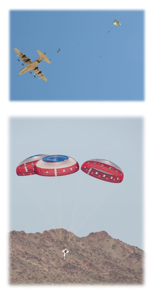
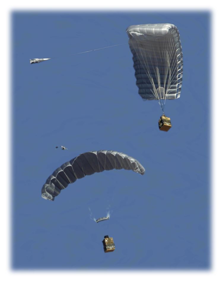
The land withdrawal would provide additional area for testing and training at YPG. The Army requests the additional area for testing advanced air delivery technologies, aviation systems, and more complex air delivery and tactical scenarios that exceed the current capabilities. Higher altitudes and greater offset distances from the targeted location are required to test the full capabilities of the parachute systems, which need larger buffer areas in the form of Surface Safety Zones than the existing area provides. A Surface Safety Zone provides a buffer above and on the ground in case of error or failure, to protect people from material dropping from the sky in unexpected places during air delivery testing and training. The affected area must be cleared of personnel not involved in the activity.
Currently, systems are not tested to their full capabilities for altitude and precision because of the limitations of land and airspace. Higher elevation and GPS-guided air delivery methods are being developed to provide better support to soldiers and other personnel in the field. GPS-guided delivery systems ensure that payloads can be delivered to the intended location. A payload is a palletized package of various weights and items, such as a vehicle, equipment, and/or supplies. These delivery systems also provide the flexibility to keep aircrews and personnel out of harm’s way (at higher elevations). Guided delivery systems undergoing development require larger safety buffers to adequately contain potential failures. The requested withdrawal area would provide expanded land space to allow for an additional safety buffer to protect the public. Without the proposed withdrawal area, drops could land in the 22,000 acres outside the current YPG boundary, where the public may be present. This could result in injury or death. The requested withdrawal would restrict public from the area and thus reduce the potential that people could be impacted.
The existing boundary between YPG and BLM lands lacks a contiguous physical landmark demarcating the two areas, which has led to unintentional public intrusions onto YPG, which can lead to cancellation/delay of testing or training activity. The requested withdrawal area extends to Highway 95, which would effectively establish the highway as a distinct physical landmark of the YPG boundary in that area, thereby improving public safety.
Proposed Action
The Proposed Action is the withdrawal and reservation for military use associated with YPG of approximately 22,000 acres of BLM-managed public land located west of Highway 95 and adjacent to YPG’s North Cibola Range. This land is needed because of the proximity to existing drop zones and the need to restrict public access from this location. If enacted into law, the withdrawal would add to, and be adjacent to, the existing 829,565 acres withdrawn under PLO 848 on July 1, 1952, as amended.
The Army’s request is that Congress withdraw and reserve the land for an indefinite period, until there is no longer a military need for the land. Withdrawing the land for an indefinite period would better accommodate long-term testing and training requirements to support these emerging technologies.